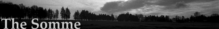
The Somme Project Diary
written by Adrian Jackson
Friday 30th March 2007
Depart Dover for France on the morning of Friday 30th March 2007.
Arrive in Calais and then midday in Arras.
From Arras we take the N.17 south to Bapaume, turning westwards towards Albert on the old Roman road, the D.929. Our journey into Albert curiously in the opposing direction taken by the eleven divisions of British Fourth Army that took their axis of advance from Albert to Bapaume on the 1st of July 1916. Of those eleven divisions involved in the initial advance, seven of them, comprising of one hundred and twenty six thousand men, were to take part in a major battle for the first time as part of Kitchener's New Army.
We pass Warlencourt, le Sars and Pozieres, eventually arriving in Albert in late afternoon.
Staying in a hotel directly opposite Albert's Basilique Notre Dame de Brebieres, site of the famous 'Golden Virgin', we confront the symbol that during the Battle of the Somme would occupy the same mythic status as did the 'Angel of Mons' where the British Expeditionary Force first engaged the German Army for the first time in August 1914, over sixty miles away north-west of Albert.
Back to TopSaturday 31st March 2007
We depart from Albert and take the D.929 heading eastwards towards the British front line prior to the 1st July 1916 situated immediately before the village of la Boisselle, in what was coined Sausage and Mash Valley. Heading further eastwards we pass Pozieres Cemetery on a steady incline, which only becomes apparent when we stop to photograph the 'site' of what would have been the initial advance of the 34th Division across the now neatly farmed fields.
We gaze back westwards towards Albert with only the pinnacle of the Basilica visible on the horizon line.
Past Pozieres Cemetery we turn north on to the D.73 on a further incline towards Thiepval, serving only to illustrate the high ground occupied by the German Army on a series of Redoubts which faced the British Army in 1916.
Driving parallel to Mouquet Farm, marked by a small memorial to the Australian Imperial Force, Lutyens' Thiepval Memorial arises into view, to our left, amongst the woodlands surrounding.
From Thiepval, through Beaumont Hamel on to the D.50 arriving at Beaucourt, the site of the old station, on to Grandcourt via the D.151, arriving mid afternoon at Saint-Pierre-Divion and the southern bank of the River Ancre, approaching from the west on the D.4151. A marker board has been erected to Edmund Blunden who was here with the Royal Sussex Regiment during the course of the battle.
From Saint-Pierre-Divion we drive southwards on the D.50 towards Aveluy Wood, presenting a view of the wood remarkably similar to contemporary photographs of 1916, with only the road replacing a dirt track. At the far end of the wood stands Lancashire Dump Cemetery renamed Aveluy Wood Cemetery after the war and which behind it is situated the River Ancre.
Arriving back in Albert - early evening.
Back to TopSunday 1st April 2007
We depart Albert and head towards la Boisselle, the first village outside Albert on the D.929 and the site of the Lochnagar mine crater.
Then further westwards on the D.929, past Pozieres and then turn southwards on the D.6 towards High Wood and Delville Wood, via Bazentin - le Grand and Longueval, arriving at the site of the South African Memorial and Delville Wood Cemetery.
Throughout Delville Wood marker stones recall London and Edinburgh Street names indicating the origins of the men who fought there, marking the location of wooded tracks and communication trenches. The evidence of trenches quite clear in the wood itself, where extremely heavy fighting took place throughout July and August, with fighting for the wood ending officially on the 3rd September. Evidence of such heavy fighting is made clear in the adjacent cemetery containing over five thousand, five hundred headstones.
Then a return westwards towards Fricourt on the D.64 through Guillemont, past Trones Wood, Bernafay Wood, through Mametz arriving late afternoon in Fricourt and the site of the German Cemetery which holds over seventeen thousand German dead.
In the late afternoon light the contrasting black cruciform head stones stand sharply out from the slightly overgrown greenness of the grass and are a marked contrast to the white headstones witnessed earlier at Delville Wood Cemetery.
From Fricourt a last journey northwards on the D.147 and the British Cemetery at Pozieres sitting directly off the D.929 and on a decline facing northwards to Thiepval.
The cemetery holds over two thousand, five hundred headstones and its surrounding walls number over fourteen thousand names. It sits in the landscape as a solitary site, its classical proportions echoing both triumphal arch and the site of victory. A commemorative site commanding to be viewed from the surrounding roads on the decline south.
Then further north towards Foncquevillers, Gommecourt, Hebuterne and Sailly-au-Bois, via the D.929, via Courcelette, through Miraumont, Puisieux on the D.6 arriving at Hebuterne, the boundary line between the Third and Fourth British Armies positioned on the Somme. The landscape here remains orchard land as was described by those who were there in 1916 and so it remains to this day.
Final destination northwards to Arras via the D.3 - arriving early evening.
Back to TopFriday 23rd November 2007
Depart Dover for Calais on the morning of the 23rd November.
Arrive in Amiens mid afternoon.
The city of Amiens is practically the capital of the British Army behind both the British and French lines, thirty kilometers from the front line. Siegfried Sassoon makes note of the Godbert Restaurant in its town centre, after dining there on the 7th July 1916, six days after the opening day of the battle.
It serves as both a clearing station and hospital for the casualties who arrive there after the first days of battle, with its barges moored in the town serving to hold the backlog of wounded. On our first evening you cannot fail to notice Amiens famous Gothic cathedral. We spend some time in an Irish Bar off the main square and then head back to the hotel before finally finding somewhere to eat in the early evening.
Back to TopSaturday 24th November 2007: Amiens to the outskirts of Albert
We leave Amiens and head towards Albert and 'the Somme' on the D.929. Almost immediately we pass through Querrieu, headquarters of the British Fourth Army in 1916.
As we approach Albert we circumnavigate its outskirts and head towards la Boisselle. Prior to entering la Boisselle we turn northwards on the D.20 heading towards Authuille and the River Ancre.
We pass through Authuille on the D.151.
The River Ancre adopts a greater significance than the battle's namesake as most of the British Army find itself stationed north of the River Somme and adopt the Ancre as its own. On a parallel timeline we are almost synonymous with the fighting that took place here in late October and November, ninety-one years earlier.
On passing through Authuille, adjacent to the banks of the Ancre, we turn on one of the immediate side roads and its southern bank is visible ahead of us. We are three kilometres from where we arrived on its southern bank at Saint-Pierre-Divion where we first hit the boggy soil of the Ancre back in March. The ground is immediately marshy as we hit it with footprint.
Further on we head towards Lonsdale Cemetery where one thousand, five hundred casualties from the 32nd Division are buried and as we walk along the track, we past the marker point indicating the British and German front line prior to the first day of battle.
As we ascend, the highest arch of the Thiepval Memorial comes into sharp focus and finally the arches at its base are revealed and a glimpse of its Great War Stone appears at its dead centre.
We continue along the D.151 and head north-west onto the D.73 and cross the Ancre nearly a kilometre north of Hamel. We stop to view the pools of the Ancre, they look tranquil but there is evidence of a communication trench where a gathering of hunters shoot sporadically for game.
We turn north-east onto the D.50 and arrive at Ancre British Cemetery, where over two thousand, five hundred casualties are buried many of them from both the Royal Dublin Fusiliers and the Royal Naval Division.
Late afternoon, we continue further on the D.50 and then turn further northwards on the D.4151 towards Beaumont Hamel and the Newfoundland Memorial Park; the undulating remains of the trenches are still very visible and the statue of the Caribou looks forwards, indicating the trajectory of attack taken by the Newfoundlanders on the 1st July 1916.
We head southwards towards Albert and then onto Amiens-arriving early evening.
Back to TopSunday 25th November 2007
We leave Amiens and head towards the German Cemetery at Fricourt. We enter the town from the outskirts of Albert on the D.938 turning onto the D.64. It is our second trip to the cemetery and one still cannot help but be moved by the inclusion and strangely ambiguous presence of Jewish headstones. The history of the German Jews and their contribution to the German war effort in disturbing opposition to the events that took place in Germany fifteen years later with the establishment of Nazi power in 1933.
From Fricourt Cemetery we head straight towards Bernafay Wood and enter the cemetery there on the D.64 where nearly a thousand casualties are buried from the 18th and 30th Divisions.
We head further along the D.64 and enter the strange pear-shaped wood known as Trones Wood, site of very heavy shelling from both British and German artillery as the wood exchanged hands during the course of the battle and much to the expense of the lives of infantrymen on both sides.
In late afternoon we head on towards our second visit to Delville Wood, I notice again the family photograph left against the headstone of a Lancashire Fusilier, first noticed on our last trip in March, it is still there, faded but still there.
As we strike very early evening we head back towards Longueval and turn northwards on to the D.107 to make our way back onto the D.929. Once on the D929 we are back on the trajectory of advance taken in the later stages of the battle and head towards Butte de Warlencourt. We ascend the Butte and view the trajectory of advance taken by the British Army from its viewing platform gazing down the old Roman Road, which is now the D.929.
As we head back down towards the D.929, to make our return journey back towards Amiens, we visit once again the cemetery at Pozieres, which sits immediately off the road; in the early evening light its classical arch dominates a rear skyline. We then head further westwards back towards Albert. The golden dome of the Basilica in Albert comes into view before we turn off at la Boisselle and visit for the second time the Lochnagar Crater.
Prior to the huge explosion witnessed here, coal-miners from both Northumberland and Durham laid underground heavy explosives in an attempt to dislodge the German defences on the first day of the battle.
Before we head back on the full return journey to Amiens we visit one last cemetery - Gordon Dump.
Gordon Dump commemorates nearly one thousand, seven hundred casualties following the fighting in the la Boisselle area. Unique to this cemetery is the one Indian casualty that is commemorated here.
Early evening and we head back towards Amiens.
Back to TopFriday 2nd May 2008
Depart Dover for Calais on the morning of 2nd May.
Arrive in Hardecourt-aux-Bois late afternoon. The immediate vicinity of the village lies near the boundary line between the British Fourth Army and the French Sixth Army at Chem des Anglais; between Maricourt and Favier Woods.
Fighting takes place around Hardecourt-aux-Bois from the 8th July, as the British 30th and 18th Divisions attack north of the village with their objective being the capture of Maltz Horn trench and farm; in addition to Trones Wood and Montauban-de-Picardie.
30th & 18th Divisions are the sum total of men who teemed into the brigades of Kitcheners 'New Army' - volunteers from Manchester, Liverpool, Bedfordshire, Wiltshire, London, Essex, Norfolk, Suffolk, Kent, Surrey, Hertfordshire, Buckinghamshire & Northamptonshire.
Alongside the British Army, the French 39th Division attack the western slopes of Hardecourt Ridge, as well as the village itself. Fighting in the village takes place in the church catacombs as well as the tunnels joining the wells and cellars.
On our arrival in the village we locate Chavasse Farm where will be staying throughout the duration of this trip.
The small walls of each residential cottage is evidenced with the remains of the War:- shell casings, spent rifle cartridges...
Inside, the walls are adorned with trench maps and bayonets - French German and British.
Back to TopSaturday 3rd May 2008
Following breakfast, our destination for the first part of the day is Dantzig Alley Cemetery, which lies east of the village of Mametz. At Dantzig Alley Cemetery lie the remains of Stephen's Great-great Uncle:
A.E. Curtis-G/1427, Private, 7th Bn, The Queen's, (Royal West Surrey Regiment).
His headstone tells us that he was in a 'service battalion', designated by the prefix 'G' before his service number, one of thousands who joined Kitchener's New Army in 1914, joining up in Guildford, Surrey in September 1914, finally destined to be one of the over nineteen thousand killed on the 1st July, aged 26.
On leaving Hardecourt-aux-Bois we head north towards the D.64 and enter the village of Montauban-de-Picardie, on its outskirts we pass a small memorial to the Liverpool and Manchester Pals.
1916: Prior to the Battle, Montauban-de-Picardie was the largest village in the Somme area. On the first day of battle, the capture of Montauban or 'Monty-Bong' as the British Army called it, fell to 30th Division, part of XIII Corps, with the French 39th Division attacking further to the right. The village fell at around midday and was the first village to fall into British hands.
Walking through Montauban, we pass a heat splintered green door with an engraved plaque above it, linking Montauban with Maidstone in Kent. Likely in recognition of those men of the Royal West Kent Regiment, who along with Stephen's Great-great Uncle, formed a further part of the 55th Brigade - Maidstone being a centre of recruitment for the Royal West Kent Regiment in 1914.
Leaving Montauban, we continue along the D.64, arriving eventually at Dantzig Alley Cemetery, the burial site of Stephen's Great-great Uncle.
In belonging to the Queen's Regiment, Royal West Surrey's, Stephen's Uncle took part in the fighting as part of 55th Brigade, 7th Battalion. Their objectives on the 1st July were largely achieved by the taking of communication trenches in the advance towards Montauban.
As we leave the cemetery we enter the very outskirts of Mametz village and turn northwards to what was termed by the British Army as 'Death Valley'; between Mametz, Quadrangle and Bottom Woods, in the Vallee St. Antonie.
As we ascend and descend through a series of lanes, Peter makes a decision on the location for tomorrow morning's photography.
On our progress north-westwards we begin to fatigue as a group and decide to cut our journey immediately southwards; adjacent to Mametz Wood. On ascending a very slight ridge we encounter the Memorial to the 38th Welsh Division, atop the memorial, a Welsh dragon stares ahead, imitating the line of attack taken ninety-two years earlier by the division it commemorates.
The Royal Welch Fusiliers held poet Siegfried Sassoon in their ranks, who took part in the battle for Mametz Wood in July 1916.
We turn back on ourselves to return back to Hardecourt-aux-Bois, passing through Montauban, in reverse order, eventually arriving in the village early evening.
Back to TopSunday 4th May 2008
We awake at 04:30 and drive out towards Death Valley adjacent to Mametz Wood repeating our tracks from yesterday afternoon. It is still dark and the morning light of dawn is still absent.
We park the van on a track to one side. A hazy light slowly allows us to seek out the woods ahead of us and the fields of rapeseed surrounding us.
We walk down a track, adjacent to Mametz Wood stopping intermittently to take allow Peter to take a photographic record.
Light finally allows colour to dominate, removing uncertain greys.
To the south-east, on a slight incline, Dantzig Alley Cemetery is revealed; identified to us by one of Sir Reginald Blomfield's crosses 'of sacrifice' on the far lip of the cemetery.
We continue on through a wooded track, overhanging branches deny us the light of a fully emerging dawn, which only becomes evident as we walk out into the open, almost on eye level terms with a slightly raised rapeseed field, fully yellow.
We return back to Hardecourt-aux- Bois and sleep until late morning.
Later that morning we split in to two groups. Sara and I commit to a further circular walk northwards, that takes us through Longueval, Guillemont and Delville Wood.
We head towards Trones Wood, passing the memorial to the 18th Division on the D.64 before turning immediately to our right. The wood itself changed hands throughout July witnessing terrible fighting before eventually falling into British hands.
Passing Trones Wood we turn immediately to our right on to the D.197, at which point there is a sense of 'expectancy' a feeling of 'imminent arrival' as I look and walk ahead, waiting for Bernafay Wood Cemetery to come into view. The 'Cross of Sacrifice' is framed by trees as we decline further forward and eventually the rest of the cemetery is revealed in the landscape.
This is the second visit to Bernafay Wood Cemetery and feelings of familiarity arise, as they do when we eventually reach Delville Wood Cemetery further on. We head towards Longueval, via Longueval Road Cemetery and Delville Wood appears on our right.
As I walk through Delville Wood Cemetery for the third time, I search for the headstone that shoulders the family photograph of the Lancashire Fusilier, first noticed on our trip in March 2007 and again, far more faded by the elements in November of the same year. It has now gone.
We head further on to Guillemont and pass the church; a Celtic cross commemorates men of the 16th Irish Division who took part in the fighting around Guillemont and Ginchy in September.
We turn on to the Guillemont-to-Montauban Road and enter Guillemont Road Cemetery. In the distance one can see Trones Wood and the rapeseed in the surrounding fields is an intense yellow, drawing the white headstones of the cemeteries into stark contrast.
The road to Hardecourt-aux-Bois is ahead of us on the left and we make our way back to the village.
Back to TopFriday 17th October 2008
Depart Dover for Boulogne.
Arrive in Boulogne late morning.
In Boulogne one senses an autumnal but bright October light; one that is sharp and clear, balanced between the English Channel and the sky over Boulogne.
It is a 'light' that is unique to coastal towns, a merged hazy coastline-brightness in the summer months; shifting to a clearer colder grey-blue in the later stages of the year.
As we navigate the town, we are reminded of both the historical and geographical importance of Boulogne's proximity to the French coastline; marked by the brief glimpse we catch of the column commemorating Napoleon's gathering of La Grande Armee, at camp at Boulogne; in preparation for the never to take place invasion of Great Britain between 1803 and 1805. The column stands at fifty-three metres high, the tallest in France.
In 1914, a rest area for British troops was established at Terlincthun, on the northern outskirts of Boulogne; being one of three major city ports to receive the British Expeditionary Force disembarking the ports of southern England. Throughout the War it also housed hospitals, medical facilities and finally a cemetery where over three thousand men are buried.
During the Second World War, it suffered heavy bombing by the Royal Air Force following the invasion on the beach heads at Normandy in 1944, in an effort stop any German Naval activity following D-Day.
From Boulogne we head in an easterly direction towards the Somme battlefields and our second visit to Chavasse Farm and its cottages. On this trip we have the largest of the three cottages available; complete with a small library and a Lee-Enfield rifle hanging on small chains from the ceiling. As a bolt-action, magazine-fed, repeating rifle, it was the standard rifle for the British Army throughout World War One.
Back to TopSaturday 18th October 2008
From the view offered from the cottage, we awake to a morning fog covering the fields immediately opposite, over a forty-five minute period the fog gradually clears and our view is transformed to a wider horizon beyond.
Prior to the trip Peter has pre-determined the photographs that he wishes to take. Our destination will be the valley referred to as 'Death Valley' by the British troops fighting in this area throughout the summer months of 1916. It is one of two 'Death Valleys' on the Somme, in our case it is an area running west of Mametz Wood, which we will approach from an easterly direction, down the D.64, for the second time this year.
Peter has also decided, in weight of our previous trips, that any successful photographs will be dependent on either a very early morning or late afternoon light. The open brightness afforded to the fields of the Somme removing the option of any other time of day. Therefore we plan to approach Mametz Wood late in the afternoon, returning on the approach we had already made earlier in May.
Our expectation of an autumnal October landscape has already been forced upon us, as we journey eastwards. We are witness to an instant and sharp contrast from the bright rapeseed fields of May, they are replaced by a limp and murky ochre of maze fields.
Mid-morning we head northwards towards Luytens' Thiepval Memorial, stopping on route at Adanac Military Cemetery; its name is a simple reversal of 'Canada' reflecting a third of Canadian burials within its cemetery walls. This is also reflected on the gate to the cemetery. Whilst unlocking the gate latch, allowing us access, an activity very familiar to us now on our fourth trip to the cemeteries on the Somme, one notices the Canadian Maple Leaf on the iron-gate.
Our attention is also drawn to those headstones commemorating men of the Tank Corps. The first we have seen. At Adanac Cemetery we are less than two miles from Flers- Courcelette, where forty-nine British tanks made their first attack on the Somme on the 15th September 1916.
We travel further northwards until we arrive at the D.4151. We continue westwards until we are at the junction with the D.73; we then turn south to the Thiepval Memorial.
Edwin Luytens' Memorial to the 'Missing' on the Somme was inaugurated in 1932, at 150ft high it stands as the largest British War Memorial in the world. It commemorates over seventy three thousand men who fell between July and 20th March 1918.
One can only comprehend the 'whole' from a distance. As one advances nearer you realises a subtle architectural maze as you view its external perimeter and its internal arches within. As you navigate memorial-wall-to memorial-wall over seventy three thousand men are listed in alphabetical order, representing each stage of the battle, throughout six months of fighting in the fields further north, south and eastwards.
At points it almost faintly echoes a Giovanni Piranesi etching, as you try to make sense of its structure, as arch eclipses arch, which further obscures the view of seeing all the names of the fallen in one huge vista, instead it is fragmentary and one is almost surrounded by the names of the fallen, emphasising the huge scale of the 'Missing' in the fields surrounding the memorial itself.
In its upper-reaches, memorial wreaths of stone heighten both a sense of triumphal arch and an appalling sense of absence. Its Great War Stone occupies dead-centre, exhorting us to remember the fallen for 'Evermore'. Finally we descend a series of stairs to the cemetery beyond, containing both British and French dead.
Of those commemorated, over ninety-percent fell between July and November 1916, representing fifty-percent of all fatalities from the 1916 battle, estimated at a one hundred and twenty five thousand dead. A rough draft of arithmetic tells us immediately that the men commemorated at Thiepval mark fifty percent of total casualties with no known grave.
As we approach late afternoon we make our way towards Death Valley and Mametz Wood. This area of the Somme has become increasingly familiar to us and a sense of recognition takes hold as we turn of the D.64 and follow the trail towards Mametz Wood.
As expected the rapeseed fields that surrounded us earlier in May are gone. The fields are bare and brown. Mametz Wood now stands out in bulky contrast maintaining a deep green in colour as the light gradually recedes.
Peter takes up position immediately left of the Wood as you face towards Bazentin-le-Petit. In May this was as far as we had walked into the Valley. For this trip we have decided to walk further on. Shortly afterwards we come to Flatiron Copse Cemetery situated immediately in front of both Bazentin-le-Petit and Grand Woods. As you face the cemetery it progresses on an incline in front of you. Designed by Herbert Baker it holds over eleven hundred men.
We then return back to Hardecourt-aux-Bois as the light fades completely.
Back to TopSunday 19th October 2008
As with the previous morning, fog obscures any view of the surrounding fields outside the cottage. Gradually it clears. We have decided to use a tour in Paul Reed's 'Walking the Somme', as an aid, choosing a tour tracing the movement of the 18th (Eastern) and 30th Divisions in the Montauban area.
This is a deliberate choice reflecting Stephen's Great-great Uncle's involvement in the battle as part of 7th Battalion, 55th Brigade, 18th(Eastern) Division.
We arrive in Carnoy. Its cemetery is famous for holding Captain Wilfred Percy Nevill, it was his platoon that signalled the advance with the kicking of footballs into no- mans- land prior to facing German machine guns.
Leaving Carnoy, we walk alongside the wooded track of Talus Boise for nearly an hour; turning onto a further open track that allows us access across an adjacent field towards the Carnoy craters. Before reaching them we are afforded an excellent view of Montauban.
As we stand at this point, we immediately realise that this is the most expansive view of the battlefield that we have had thus far. Montauban stands immediately ahead of us, to its right both Bernafay and Trones Woods are in view. Bernafay Wood clearer and deeper in colour, Trones Wood faded, but sill in view behind.
The wide horizon line ahead is in distinct contrast to the wooded shadow of Talus Boise that had accompanied us for the previous hour along its track. Our perceptual leap of the battlefield has provided us also with an equally expanding and increasingly proportionate sense of scale of the battle itself, which we can now measure in visual miles on the horizon line ahead of us.
We begin to understand the sheer space occupied by numerous British infantry divisions as we gaze ahead of us.
We further imagine both Mametz and Fricourt to the left of Montauban in the distance that sits just beyond our visual grasp.
On passing the Carnoy craters we then head into Montauban itself, walking to the edge of the village, we again pass the small memorial to the 'Pals' battalions that took part in the fighting for Montauban on the 1st July; commemorating men from both Manchester and Liverpool.
As we hit the middle of the day, we head for Bray-sur-Somme and the River Somme itself. For lunch we stop at Cappy. On making our way down to this the southern most part of the Somme battlefield, the surrounding landscape is not so densely interwoven with cemeteries as is the case further north of the river.
Late afternoon we again make our way into Death Valley and Mametz Wood, we walk further and further along the track, past Flatiron Copse Cemetery and head onwards until we are in between the two Bazentin Woods. At this point we have met the D.20 and Peter takes up a position for a photograph looking back down onto Death Valley.
We then head back along the track before the light begins to drop and our final evening in the cottage at Hardecourt-aux-Bois.
Back to TopMonday 20th October 2008
Once we awake, we pack and then head for Boulogne and our journey back home.
Back to TopSunday 8th February 2009
Depart Folkestone for Calais.
Arrive in Calais late morning.
As we approach Calais via the Channel Tunnel and emerge into daylight, its neo- Flemish town hall comes into view on the Calais coast line. At its belfry it stands at seventy-five metres high. Work began on its construction in 1911, which was interrupted by the First World War; when it was damage during the conflict and its final construction was completed in 1925.
During the War, it was a major port delivering both men and arms into the Western Front. On the cessation of hostilities, following the Armistice, it witnessed serious disorder in 1919, whilst Allied soldiers awaited demobilisation after four years of war.
Twenty two years later, in 1940, Calais witnessed heavy fighting prior to the fall of France and the evacuation of the British Expeditionary Force at Dunkirk. In supporting that retreat the 2nd Battalion of the Queen Victoria's Rifles held in check two German armoured divisions who would have certainly turned on the retreating British Expeditionary Force if not held in check. All riflemen were killed or taken prisoner during Calais' defence. A memorial to Queen Victoria's Rifles sits on its beach, twenty one miles from the English coastline.
We head towards the town-centre to find somewhere to lunch; on driving towards the centre one cannot escape the proliferation of post World War Two architecture, testament of Calais' near destruction during the Second World War.
On leaving Calais, we head again to the battlefield on the Somme. Our destination is the village of Longueval and the site of one of the fiercest areas of fighting throughout the course of the battle, Delville Wood.
Once in Longueval and on our arrival at the house, we discuss a story linking its inhabitants, during the Second World War to the French Resistance who were captured and then taken away; no doubt to their deaths.
The house is only a short distance from the cross-roads that link Longueval to the rest of the battlefield, its road signs stating ever increasingly familiar names to us, on this, our fifth trip to the battlefield and our first in 2009. There is snow on the ground and in the distant landscape ahead.
In the evening we watch the Imperial War Museum's 'The Battle of the Somme'. Filmed in a documentary style, throughout the course of the battle, Geoffrey Malins' images, filmed almost in parallel with the birth of cinema, provide us with what are now some of the most iconic images of the First World War: British soldiers marching on the roads of Picardy, staring back self -consciously into the camera whilst on the march, waving their caps, helmets, Lee-Enfield rifles and Lewis guns. Forced cheeriness expressed through toothless laughs and smiles.
The purpose of this trip is to try and capture an image of the 'full' moon; which is due to appear tomorrow night. We head out in the direction of the D.20 to scan the sky for evidence but unfortunately the cloud cover is quite heavy and we are unable to locate the moon in the sky above us.
A 'lunar-light' is however evident, as we are able to see the road ahead of us with little need of a torch or street lamp. The sky takes on an almost luminous deep Prussian blue in tone, before noticing a more complete darkness ahead of us.
Back to TopMonday 9th February 2009
On traversing the battlefield in October 2008, we walked for a second time down 'Death Valley', immediately adjacent to Mametz Wood. On walking the length of the valley we finally emerged on to the D.20, where we were able to look back over the valley from the vantage point of the Bazentin Ridge.
Now in 2009, from Longueval, we set a course to walk the length of the D.20, taking us to our last reference point of October 2008; between Bazentin -le-Petit and Bazentin-le-Grand. Our walk from Longueval to the two Bazentin Woods will echo the course of the Battle of Bazentin Ridge nearly ninety three years earlier.
On course we pass a new memorial, dedicated in July 2002, to the 'pipers' of the Great War. In the context of the fighting that took place in Longueval and Delville Wood, it focus' immediate reference to the 9th (Scottish) Division, who would take part in the battle here in July 1916.
The Battle of Bazentin Ridge, July 1916.
14th July at 03:20 1916: A five minute artillery bombardment is unleashed against the German line followed five minutes later, at 03:35, by the first wave of British infantry of the 21stand 7th Divisions advancing towards Bazentin- le-Petit Wood and the village of the same name, an advance from the northern edge of Mametz Wood. Facing them were the 'Flatiron', 'Villa' and 'Circus' trenches.
Following this attack, the villages of Bazentin -le-Petit, Longueval and Trones Wood are captured.
14th July, two battalions of cavalry, the 20th Deccan Horse and the 7th Dragoon Guards from the Secunderbrand Brigade, 2nd Indian Cavalry Division; attack High wood. This is the first and last time that a cavalry charge takes place on the Western Front. The attack, a heroic but inevitably hopeless anachronism from a previous century fails to take the wood which finally falls into British hands on the 15th September.
On the 15th July fighting begins in Delville Wood a name that would become synonymous with the South African Brigade.
As we leave Longueval, we progress along the D.20. Snow is still on the ground and the sky ahead of us has taken on a milky, foggy light, an off white tone that is due to the cloud cover preventing a clearer and colder light breaking through. Our expectation of witnessing the 'full' moon later that night is diminished because of it.
As we progress along the D.20 we reach Caterpillar Valley Cemetery, the sight of snow here is strangely moving and incongruous to previous experiences of walking the Somme battlefield. One wonders whether those fighting in 1916 ever experienced snow between the months of July and November in 1916. It also a physical reminder of the sense of 'in perpetuity' sited at the entrance of all Commonwealth War Graves cemeteries. Regardless of the dates of the battle and other battles on the Western Front, they are now a permanent feature of the surrounding landscape and at that point the landscape then becomes part of the fabric of memory.
A further act and addition to the communal memory of the Great War was made on the 6th November 2004, when the body of an unidentified New Zealand Soldier was removed from Caterpillar Valley Cemetery, handed to the representatives of the people of New Zealand and interred into the Tomb of the Unknown Warrior in Wellington, New Zealand.
Sidney C. Hurst referred to the cemeteries of the Great War as 'The Silent Cities', in his 1929 illustrated guide to the Western Front. The metaphor of a Great War cemetery echoing a 'walled-in' community of the dead, welded into the surrounding landscape is reinforced further as Thistle Dump Cemetery comes into to view on our right, further down the D.20.
Its cemetery walls appear in dark linear outline, two of it sides in opposing direction to the equally dark troughs of the field beyond. It is in stark contrast to the maze and rape seed fields witnessed earlier in May 2007.
The dark February fields take on the appearance of a Flanders field further north.
Immediately outside Bazentin-le-Grand, marked by a rusting road sign, an iron cavalry embedded in a wooded copse takes our attention.
We head on to the two Bazentin Woods and arrive at where we ended our October walk at the end of Death Valley. Later that evening the cloud cover completely negates the opportunity of observing a 'full' moon; the surrounding sky still taking on an all encompassing luminous deep Prussian blue.
Back to TopTuesday 10th February 2009
We set out in the morning by van as the weather is wet, windy and very cold. We head north on the D.107 for High Wood, the scene of very heavy fighting throughout July, August and September with appalling casualties. We are denied access to it by a perimeter fence surrounding but we hope to return later in the year if access is possible. However we visit London Cemetery and Extension opposite where many of the dead fighting for High Wood are buried.
Outside the cemetery walls we notice a broken and heavy fragment of a Commonwealth War Graves Commission headstone, it has no name inscribed and doesn't appear to be an act of vandalism but rather a replacement stone that has been disregarded but its appearance outside the cemetery walls remain unsettling.
Our journey continues back down the D.107 and a return on to the D.20. Along its length we are afforded a view of Pozieres Cemetery on the horizon line to our right. Its classical columns appear stick like and stretched out. At its height, in the distance, it sits just above the horizon line. It has the appearance of a classical ruin sitting in an ancient landscape.
Continuing along the D.20 we head for Dantzig Alley Cemetery turning south on the D.147, pass Fricourt and Mametz arriving at the cemetery on the D.64; where Stephen will be leaving a laminated photograph of his Great-great Uncle. As the photograph is placed against the headstone careful attention is applied to mount as much soil as possible at is base to prevent the wind from blowing it away.
We then head for Peronne where we have lunch and visit the Museum.
Very late that evening we head into Delville Wood, where Stephen attempts to take a recording of the wood itself.
Total silence.
In the darkness we are able to make out the broad mass of the South African Memorial, testament to the South African Brigade who endured heavy fighting, day and night, under the most appalling conditions from the 15th until the 20th July. The Wood itself falling first into British and then returning back to German hands with small pockets of fierce resistance maintaining the battle for the wood until its conclusion. No less than seven British divisions, the 2nd, 3rd, 7th, 9th, 14th 20th 24th including the 53rd Brigade of the 18th (Eastern) Division took part in the fighting before it finally fell into British hands on the 3rd September.
Back to TopWednesday 11th February 2009
Prior to driving to Calais and returning home, we visit the northern end of the battle and drive up to Serre , noticing a place to stay for a further trip. We then head for Calais and home.
Back to TopMonday 13th July 2009
Depart Dover early afternoon
Arrive in Calais mid-afternoon.
Leaving Calais we head towards the 'Somme', arriving late afternoon at its southern most point, adjacent to the River Somme itself. As we turn in a northerly direction towards Hardecourt -aux-Bois the surrounding fields present a range of ochres-to- silky brown tones: barley, wheat and at almost head height, sweet corn in colour blocked squares.
The undulating slopes, the gradation of colour tones and the shifting, seasonal, patterns of light across the landscape become an increasing visual note accompanying the mile-after-mile of committed walking across the battlefield.
First-hand experiences of walking the landscape have turned into a series of embedded contrasts across the months of February, March, May, July, October and November.
We eventually arrive at the cottage in Hardecourt-aux-Bois in late afternoon.
That evening we head out to Dantzig Alley Cemetery via the D.64, through Montauban and in the direction of Mametz, to attempt to place a more permanent, laminate mounted photograph at the base of the headstone of Stephen's Great-great Uncle, Arthur Curtis, who fell on the 1st July, fighting in the 7th Battalion, 55th Brigade, 18th(Eastern) Division as it attacked the stretch of German trench known as the Dantzig Alley.
The ground at the base of his headstone is dry and it takes two or three attempts before Stephen is certain that it will stay in place. On leaving the cemetery I notice again the plaque commemorating the Royal Welch Fusiliers, an elongated rectangle of Portland stone embedded in the cemetery's red-brick wall. We then head back to the cottage and that evening we briefly join the inhabitants of the village in commemorating the eve of Bastille Day.
Back to TopTuesday 14th July 2009
Throughout our last three trips we have concentrated much of our walking west of Hardecourt-aux-Bois, towards Mametz and then onwards further north towards Bazentin. On this trip we decide to head immediately north in the direction of Guillemont, the site of bitter fighting during the final days of July 1916.
We leave Hardecourt-aux-Bois and begin walking in northerly direction towards Guillemont. The round-about- walk that we have planned should take us approximately four hours. As we walk the village church in Guillemont comes into view and then sinks slightly below the horizon line, its steeple sliding up and down at a ninety-degree angle against the horizon line.
We arrive at the outskirts of Guillemont at midday.
On the approach road to the village we notice a road sign commemorating Ernst Junger, author of 'The Storm of Steel' and German storm-troop officer, who fought in Guillemont, whilst serving as a Lieutenant in the 73rd Hanoverian Fusilier Regiment. We turn left towards the village church and another road sign commemorates the 16th (Irish) Division, who with the 20th Division captured Guillemont on the 3rd September. Further evidence of the 16th (Irish) Division's part in the battle for both Guillemont and Ginchy is commemorated in the memorial form of a Celtic-cross, adjacent to the village church.
We then turn eastwards towards Combles on the D.20; as we walk we come across a memorial to the 20th (Light) Division, battalions originating from Shropshire, Oxfordshire, Yorkshire and Liverpool.
We enter Combles, where we stop for lunch. Refreshed, we then head to its southern outskirts to visit the Guards' Cemetery. On approaching the cemetery, one is faced with a carpet of grass laid across a field that funnel's visitors to its walled enclosure, sitting slightly raised off the road.
We then turn in a southerly direction back towards Hardecourt-aux-Bois. Along a dirt-track as we head towards the D. 146 B we observe three very large harvesting vehicles at varying distances from each other in a field to our right. They churn the remains of the harvest creating vast dust clouds in their wake. Their huge hulks are silent in the distance.
That evening we visit the Thiepval Memorial; on arrival I make my way to the shiny black registry box, the sheer amount of red-coated Commonwealth War Graves Commission registers, crammed one on top of the other is a poignant reminder of the sheer number of the 'missing' commemorated on the Portland stone walls. I scan the registers and arrive at the sections covering surnames beginning with 'T'. I eventually find the entry for 'A.E. Turley' and direct myself towards 'Pier and Face 5A and 6C', listing those men who fought with the Worcestershire Regiment. I gaze half-way up and ahead of me is A.E.Turley, I immediately recall the pages of David P. Whithorn's 'Bringing Uncle Albert Home' , an intimate and detailed history of his uncle who fell on the 24th August 1916 whilst taking part in an attack on the Hindenburg Trench with the 3rd Worcestershire Regiment; which formed part of the German defensive network of trenches known as the Leipzig Salient.
Back to TopWednesday 15th July 2009
We head out again to the Thiepval Memorial and the German Cemetery at Fricourt, before moving onwards to our final destination for the day - Peronne. On route we pay a third visit to the Lochnager Crater outside la Boisselle. We circumnavigate its perimeter- edge, noticing at its deepest and most central point a 'bulls eye' of poppies, laid during recent commemorative events.
Although Peronne is not, strictly speaking, a part of the Somme battlefield, it is marked by history in the fact that it fell to the German Army in both 1870, during the Franco-Prussian War and in 1914, in the opening stages of the First World War. Gerald Gliddon notes in his 'Somme 1916, A Battlefield Companion' the efforts taken to restore its buildings to their original state after both conflicts.
Particular reference is made to a milliner's premises, which, built in 1792 was destroyed in 1870, only to rebuilt in 1873; destroyed again in 1916 to be finally rebuilt in 1924.
We stop for lunch opposite the remains of the town's medieval castle, which now houses the 'Historical de la Grande Guerre', before returning to Hardecourt-aux-Bois.
Back to TopFriday 26th February 2010
Depart Dover mid-morning Friday 26th February 2010
Arrive Calais early afternoon.
This is our first trip of 2010 and the second that we have journeyed during the month of February. As with that undertaken in 2009 our trip of 2010 will be marked by the presence of a full-moon on the evening approach.
There is, however, a marked absence of snow that peppered the tops of cemetery headstones and covered the surrounding fields of Longueval, Bazentin-le-Petit and Grand, as we walked amongst them almost exactly a year before.
On leaving Calais, we head towards the battlefield, each trip, since our first in March 2007 serves to ignite a palpable sense of familiarity underlined by the familiar road signs pointing out villages that have embedded themselves in the British collective memory over the subsequent 90 years following the Battle of the Somme.
Our destination is Foncquevillers, known to the British Tommies stationed there in 1916, as Funkyvillas. Of the British divisions most associated with the village, the 46th Division stands out. Men from the Midland towns of Staffordshire, Leicestershire and Derbyshire, who made it their own and many of the communication trenches in the surrounding area mark the names of regiments from the Midland towns of England.
We arrive in Foncquevillers and locate our hotel after being lost for a short while, reminding us that this is our first detailed excursion to the northern end of the battlefield; a departure from the more familiar surroundings of the cottages of Hardecourt-au-Bois and Longueval further south. Shortly after our arrival we head out to explore the surrounding area of Foncquevillers, past the Newfoundland Memorial Park at Beaumont Hamel, as far down as Thiepval and then the pools of the River Ancre; stopping intermittently to take stock of the undulating landscape, as we mark the contrast to the flatter fields further south.
There is clear blue light and many of the wooded areas still maintain a deep emerald green, whilst the surrounding fields are a deep brown - in anticipation of the spring months ahead and the onset of yellow blocks of rapeseed which will surround us on our return in July. We head in the direction of Mametz and Dantzig Alley Cemetery to gather at the headstone of Stephens Great-great Uncle: G/ 1427, Private A.E. Curtis.
On route we are transfixed by a sunset encased in the arches of the Thiepval Memorial, itself book-ended by brown-green clusters of trees at each end of its surrounding arches, leaving only its central arch to magnify and frame the fading light.
On arriving at the cemetery we immediately make our way to A.E. Curtis headstone; our thoughts are all aimed at the laminated photograph that Stephen laid at it base the year before. Had it survived the onset of the seasons and a year of changing weather?
The photograph remains in place, barely faded.
As we leave the cemetery I notice, further to the right, a photograph at the base of the headstone of 15243, Private, H.R.Hurst, who as a member of the Leicestershire Regiment fell on the 14th July, 1916. The photograph has faded a little and takes on blue-grey tone, making it difficult to follow the contours of the face and eyes staring ahead.
Back to TopSaturday 27th February 2010
We leave Foncquevillers for Hebuterne. From Hebuterne we start walking in a southerly direction towards the Serre Road. At its outskirt sits the village church; within its shallow outer wall a statue depicts Christ on the Cross, at its base tree roots are sculpted into the soil. To its left a memorial to civilians and soldiers alike, commemorating those killed in the First World War, atop strides a French infantryman pushing forward a victory wreath.
On the low outer wall, a memorial to the Bradford Pals commemorates men from the 16th and 18th infantry battalions of the West Yorkshire Regiment; who were to take part in the 93rd Brigade, 31st Divisions tragic attack across the upward slope towards the village of Serre, on the opening day of the battle.
At the southern outskirts of the village we head southwards on to a road that runs parallel with the site of Vercingetorix Trench; marking the presence of the French Army prior to the British take over of the sector in July 1915. Its name commemorates the leader who united the Gallic tribes against Julius Caesar in their revolt and inevitable bitter, starved defeat, at the Siege of Alesia in 52BC.
Further along the track is a communal cemetery which holds both French and British casualties, further still a barn with 1923 marked-out in bricks at its apex; boldly stating its final rebuild, following artillery damage during the Great War.
As we progress along the track dud artillery shells are on either side of its edges against the surrounding field; in addition to rotting cobs of corn two very different harvests reaped from the ground by local farmers.
The presence of old rusting munitions on the tracks edge; half buried in an incongruous silence, contradicts their original destructive purpose on leaving the barrels of British, French and German artillery guns, ninety-four years earlier- all now muted in mud.
The track then comes to an end and we decide against crossing the open field towards Serre, as it is clearly marked private property. We decide instead to head back to Hebuterne, repeating our steps, before heading further onwards to Serre Road Cemetery No.2.
In Hebuterne we stop for lunch in one of the village bars. As with so many bars in the villages on the Somme, dusty copies of photographs sit in windows; distant testament to the damage each experienced during the course of the fighting.
Inside are the innumerable display of artillery shells on shelves; some are polished, displaying decorative inscriptions, others remain rusting testaments, payloads in all calibres, retrieved from the surrounding fields.
The largest cemetery on the Somme, sitting astride the D.919; Serre Road Cemetery No.2 occupies that part of the German front-line referred to by the British as the Quadrilateral or alternatively the Heidenkopf by the Germans. A formidable redoubt with a four-hundred yard frontage that arrow-headed from the German trench system into the British front-line; it was heavily defended with machine guns and strewn with barbed wire and wide trenches.
On the 1st July it was one of the few but temporary British successes when the 1/8th and the 1/6th battalions of the Royal Warwickshire Regiment stormed the Heidenkopf, the few survivors returning to their trenches later in the evening.
It holds over seven thousand headstones, at its centre sits a Great War Stone. From that point one can gaze back through the central arch at the entrance to the cemetery, framing the landscape beyond.
As we progress further down the D.919 we locate the track that will take us to the British front-line and assembly point, prior to the attack on the 1st July - the wooded copses, south to north: Matthew, Mark, Luke and John. As we head down the track a plaque to the 93rd Brigade sits low down on a wall, alongside the 94th Brigade they would make up the attack by the 31st Division against Serre.
The four copses of 1916 were replanted after the War with the exception of Matthew Copse. It is now one single wooded area and holds the site of Sheffield Park, a memorial site commemorating those Pals battalions who were to fall so tragically on the first day of battle.
As we head towards the park, down a wide track, Serre Road No. 3 Cemetery and Queens Cemetery come into view. The clear light has a sharp quality to it and both the cemeteries and the wooded area further on are not softened in the distance as we view ahead.
The cemetery walls stand in stark outline just above the horizon line.
Before walking further forward, I notice a further series of narrow tracks. My eye follows their impressions across the fields ahead of us. Some exist on our French Institute Geographique National (IGN) maps, which have accompanied us since 2007; others are far more recent. Both serve to provide access to local farmers and visitors alike. In the winter they are brown etched on to the landscaped; in the summer they provide gaps between the curtains of field crops.
The tracks of course lead us to what was the British Front Line in 1916, as it reveals itself in the fields in addition to the Commonwealth War Graves cemeteries, often both in close proximity.
I have begun to take a photograph of either an individual or a series of headstones that later serve as an aide memoire when recording where we have been on each relevant IGN map - then cross referencing the name on a headstone with the Commonwealth War Graves Commissions Debt of Honour Register.
In a sense, it is an instant act of commemoration.
In all cases an unknown name, to us, amongst thousands equally unknown; each however belonging to a regiment recognised communally to many; documented for posterity in the vast literature recording the course and history of the battle.
In Serre Road Cemetery No.3 I pull out from my view
15453 Private
C.Widdop
East Lancashire Regiment
1st July 1916
On the same headstone further below is recorded
15/ 1327
W. Stewart
West Yorkshire Regiment
1st July 1916
The headstone stands apart in contrast to those around it - two names are identified. The headstones immediately to the left and right record in anonymity:
Three soldiers of the Great War
An officer of the Great War
Two soldiers of the Great War
A private of the Great War
The Commonwealth War Graves Debt of Honour Registry tells us no more about C. Widdop or W. Stewart that isnt already noted on their headstone. We are left with names and in both cases their ages are unknown.
Veering to the left, the track finally leads us to the edge of the park and the site of the British Front Line of 1916. On entering the park, memorials to the Accrington and Barnsley Pals dedicated in the 1990s emerge from the trees; the memorial to the Accrington Pals sitting at seven-feet tall, made exclusively from Accrington bricks. Adjacent to the memorials are the remains of a trench and further below, Railway Hollow Cemetery, itself the site of the British Support Line.
We spend some time here, trying to mark out Serre village ahead of us and contemplatively observe the remains of a British front line trench and the deep shell holes at our feet; evidence of the murderous German artillery barrage that pounded the men of the 93rd and 94th Brigades as they advanced forward on the 1st July.
The results of the advance are perhaps most poetically and tragically recorded by Gerald Brennan in his A Life of Ones Own, first published in 1962. In it Brennan describes the attack:-
The sun rose higher and higher in the sky, the heat of that scorching summer day grew and grew, but though I was never able to get any coherent picture, the failure of our assault on Serre gradually became obvious. Those three or four hundred yards of rough ground that lay in front of our lines were thickly sprinkled with silver triangles, only a few of which still moved, while the German parapet was bare. And the pounding of our trenches went on
The silver triangles that Brennan refers to were those that were stuck to the backs of the advancing British infantry, to enable artillery spotters to locate the advance of troops across No Mans Land.
We head back to Foncquevillers -retracing the route of our earlier outward journey.
Back to TopSunday 28th February 2010
Before we head back to Calais we stop at Thiepval Memorial. The Memorial is sealed off for what looks like renovation work and an overcast sky develops into torrential rain and impedes our progress any further. We then head onwards to Calais for an early afternoon crossing in what promises to be difficult weather conditions.
Back to TopWednesday 30th June 2010
Depart: Dover for Calais early morning, Wednesday 30th June
2010
Arrive: Early afternoon in Calais
Following Februarys trip to Foncquevillers, Hebuterne and Serre; at the northern end of the battlefield, we have returned to the cottage in Longueval.
As noted in an earlier diary entry, to the right of the cottage, in the village square, stands the Pipers Memorial. On arrival, I pay closer attention to the curious leaning pose than before. It depicts a piper climbing the parapet of a trench at the head of an attack. It commemorates all pipers who fell in the First World War and who led men into battle regardless of incessant shelling and the hail of bullets surrounding them.
We passed it for the first time, traversing the snow peppered fields either side of the D.20, back in February 2009, on route to Bazentin.
The cottages short proximity to Delville Wood guarantees that we are drawn into it each time we stay; Its squat obelisk stones, marking out the previous location of communication trenches, with wide grassed boulevards separating wooded areas apart.
Each visit is further marked by the impressive South African Memorial, atop which stand the classical figures of Castor and Pollux, with a horse between them, representing the unity of South Africa and Great Britain as allies at the site of some of the fiercest hand-to-hand fighting of the whole Somme battle.
The trees are in full summer growth and canopy over the visitor like a leafed arcade leading up to the memorial itself.
On this trip we have decided to focus on the First World War cinematographer Geoffrey Malins. This will take us to the Hawthorn Ridge mine-crater, the Sunken Lane and White City all immortalised in his film the Battle of the Somme.
Back to TopThursday 1st July 2010
Ninety-four years to the day, remembrance activities will take place at both memorials and in villages on the Somme, to mark the fist day of the battle. Each village marking its progress as it was fought throughout the summer, autumn and winter months of 1916.
We head out in the direction of Serre, on the D.919 and pick up a track located just before Serre Road Cemetery No.2, which we walked earlier in February. Peter and Reuben are keen to film a large artillery shell, previously noticed, as it lay dormant at the very boundary edge between track and field.
Unfortunately the shell has either been removed or buried-over by the turn of the harvest.
The track leads us out to the site of Redan Ridge. We walk until we reach a V shaped junction where a crucifix stands adjacent to Redan Ridge Cemetery No.3; a small cemetery atop a chalked mound.
Redan Ridge stands between Serre - where the British attack was undertaken by the 31st Division and Beaumont Hamel where a simultaneous attack was undertaken by the 29th Division on the 1st July.
The 4th Divisions attack on Reden Ridge belongs in particular to the 11th Brigade. Tragically cut down by machine gun fire, in grim symmetry to the attacks at Serre and Beaumont Hamel.
The 4th Division was a Regular Army division and still held survivors of the British Expeditionary Force that came over in the early battles of 1914-15; before Kitcheners New Army swelled out its ranks with civilian soldiers.
As we progress along the track, on a steadily increasing incline, the back of Serre Cemetery No.2 comes into view, soon followed by Redan Ridge Cemeteries No.1 and No. 2. Redan Ridge Cemetery No.2 sits on the horizon line with its Cross of Sacrifice being the only visible point of reference in the surrounding field - in the absence of any visible cemetery headstones.
I climb onto the bank of a field but the headstones still sit below the top-edge of the crop in the field ahead.
There was expectancy that the surrounding fields would be blocked in yellow rapeseed; a familiar sight to us during the spring and summer months. Instead the fields are a green turquoise; which we believe to be fields of barley.
We eventually reach the outskirts of Beaumont Hamel, with the church and steeple in full view. We dont enter the village but rather turn onto the D.4151 heading south towards Thiepval followed by the D.50 and D.73 after crossing the River Ancre.
We pass the memorial to the 36th (Ulster) Division. A memorial service has just finished as people gather at the entrance to the Ulster Tower - a replica of Helens Tower that stood in the Clandeboye Estate in Bangor, County Down, where many of the men in the division trained before leaving for England and eventually France.
On route back to Longueval, via the D.64, we stop temporarily at Montauban and witness two pipers playing at the Memorial to the Liverpool and Manchester Pals. It is a very hot day and on completing their lament they hastily drink from a water bottle, offered to them by a member of a French Honour Guard.
In late-afternoon we head out to the area surrounding Beaumont Hamel to allow Peter and Reuben to record their references to Geoffrey Malins:- Hawthorn Ridge mine crater, White City and the Sunken Lane; all permanently etched on Malins black and white film.
The images of men from the 1st Lancashire Fusiliers staring into Malins camera, prior to going over the top, are in equal measure painful and poignant to watch. A Lancashire Fusilier, with jet- black hair, cut in a pudding-basin style, stares out, clutching his Lee Enfield rifle.
Standing in the Sunken Lane is understandably eerie, a feeling felt by all who must visit here.
The concrete visual and filmic record of helmeted faces at the exact spot of where you stand - smiling, gesturing, talking and engaged in the task ahead of them, seems to place us very near to the event as it unfolds, before memory and remembering takes place.
Stephen and I walk along the Lane until we come back onto Redan Ridge with a view of the church and steeple in Beaumont Hamel to our right. As we stop and look we are provided with a panoramic view of the British Front Line as it stood in 1916.
White City is now a flat scar of white chalk.
We then make our way to Hawthorn Ridge mine crater.
On the 1st July the mine, which contained 40,000 pound of explosives, was detonated ten minutes before zero-hour at 07:20am. The failure of the British infantry assault at the northern end of the battlefield has been credited by many to the fact that the mines early detonation alerted the Germans to an imminent infantry attack.
The delay between denotation and infantry assault giving the Germans a valuable ten minutes to prepare their machine guns prior to the British advance at 07:30 (Zero hour).
The tragedy of the First Day of The Somme and the fate of so many civilian soldiers who volunteered in such large numbers in 1914 is perhaps most powerfully and disturbingly recorded in a reference to the Sheffield Pals who fought at Serre:-
Two years in the making. Ten minutes in the destroying.
A small wire fence now surrounds the site of where Hawthorn Ridge mine crater was detonated but it is broken intermittently around its perimeter. We make our way to the base of the crater where there are remains of a temporary camp site, strewn with plastics bottles.
It still remains an impressive site and like the Lochnagar mine crater at la Boisselle, the brutally huge spoonful like scoop from the landscape still packs a strong visual punch on first impact, ninety-four years since initial detonation. There are however distinct differences, the Lochnagar crater has become a formal commemorative site; necessary but tidy. The crater at Hawthorn Ridge, clumsily surrounded by trees, seems a rawer testament to the power and technologies of industrialised warfare, clear evidence of what can be achieved against an impassive landscape.
We arrive back at the cottage and then prepare for an evening meal.
Back to TopFriday 2nd July 2010
We head to Amiens for lunch against a backdrop of the River Somme, followed by a visit to the cathedral which houses the largest medieval interior in Western Europe containing 126 pillars. Within its interior there is a plaque to the Australian Imperial Force who defended Amiens from March to August 1918 and received the following valediction from the Bishop of Amiens at the end of the war:-
As Bishop of Amiens I owe you and your illustrious dead my heartfelt thanks because the land of my diocese has been your field of battle, and you have delivered it by the sacrifice of your blood. During the painful days of the invasion you made a rampart of your breasts, behind which you shielded and saved the last shreds of my territory the children who in coming centuries will grow up in your homes and schools, will learn through your good deeds the lessons of patriotism. They will not be able to pronounce your name without speaking of the towns, villages, tablelands, ridges and valleys of the Somme.
We return back to Longueval and after a brief respite, make our way out again. Turning south from Longueval, onto the D.197, we pull over to witness the beginnings of a thunderstorm. A white eye becomes clearly evident as storm clouds gather portentously around its centre. We take cover in the van, sitting in a lay-by next to Longueval Road Cemetery.
I enter the cemetery and take a reference shot of a headstone:
4312 E. Levy
15th November 1916
50th BN. Australian Inf.
The Commonwealth War Graves Debt of Honour Registry tells us that Elias Levy was the son of L. and Betsy Levy, of 83, Halifax St., Adelaide, South Australia. He was also born in England.
Soldiers of 50th Battalion (South Australia) were part of the 13th Brigade, Australian 4th Division. Formed in Egypt before for disembarking for France; it is likely that Private Elias Levy took part in heavy fighting at Pozieres, Mouquet Farm and Flers throughout the course of the battle, before he finally fell on the 15th November 1916.
A memorial to the Australian 4th Division sits on the heights of Les Chaudries at Bellenglise, north of the St Quentin canal.
After the Somme, it took part in heavy fighting whilst assaulting the Hindenberg Outpost Line; in September 1918.
We remain to watch the course of the thunderstorm, now recorded on film and then head back to the cottage at Longueval.
Back to TopThursday 30th September 2010
Depart Dover for France on the morning of Thursday 30th
September 2010
Arrive Lunch time in Calais
On departing Calais, for the third time this year, and in years previously, we pass the remaining monoliths of German costal fortifications from the Second World War - once a militarised zone and Hitlers bastion of defence against Allied invasion; transformed now into a graffitid archaeological theme park for local French youth to gather and to leave their more permanent graphic mark on the aging grey hulks.
We arrive on the Somme at Hardecourt-aux-Bois late afternoon. Prior to dinner we head out towards the southern tip of the village; a road sign points us in the direction of Maricourt. The two woods ahead of us lie in front of Maricourt Wood and mark the advance of the French Sixth Army on the 1st July. Both Reuben and Peter begin recording images at this southern end of the battlefield.
Back to TopFriday 1st October 2010
On this trip we have decided to head into Caterpillar Valley, in addition to exploring the surrounding wooded areas of Fricourt. Caterpillar Valley itself lies immediately north of Montauban on the D.64, before the incline to the Bazentin Ridge. At the base of the valley sits Quarry Cemetery which marked both the site of an aid station and Brigade headquarters during the course of the battle.
Following the capture of Montauban on the 1st July by the 18th and 30th Divisions and the capture of Mametz and Fricourt on the 1st and 2nd July respectively by the 7th Division; Caterpillar Valley lay ahead. On the 4th July the 10th Essex, (53rd Brigade 18th Division) captured Caterpillar Wood and on the 11th July, the 9th Devons (20th Brigade, 7th Division) reached Caterpillar Valley on the far bank of the depression but this was unable to provide adequate shelter from German howitzers, casualties were heavy and the fighting was incessant, British gains were measured in yards. Across this area of the battlefield fighting was also taking place in Mametz, Bernafay and Trones Woods.
The military historian Basil Liddell Hart fought here in the 9th Kings Own Yorkshire Light Infantry, where the German Caterpillar Valley Barrage took its toll as men tried to find shelter in shallow holes covered in corrugated iron and earth. The British also crammed the valley with every possible calibre of artillery gun:- 4.5in Howitzers, 60-pounders, anti-aircraft guns and 18-pounders.
Gerald Gliddon describes in his Somme 1916, A Battlefield Companion the incredible sight of horse-lines, being cut loose, so as to avoid heavy losses from a sudden and devastating German artillery barrage. Once free and panic-driven in the midst of smoke and the deafening roar of exploding shells ; the horses stampeded the length of the valley, as far down as Fricourt, before they were rounded-up hours later.
We descend into Caterpillar Valley via a track that lies just outside the eastern edge of Montauban; entering through a gate of trees that firstly obscures our immediate view of the valley ahead of us and then on to a road that joins the D.64 and the D.20 at each end of the valley.
At its approach we are able to make out Bernafay Wood and the northern pear-shaped tip of Trones Wood. The trees are all on the left hand side of the road and are neatly cut at a height which exposes their silver trunks down the roads length.
We arrive at Quarry Cemetery, once inside its walls we watch a group of local gardeners attend to rows of regimented headstones. Flowers are laid out on tarpaulin sheets, before being planted in neatly turned over mud at the bases of headstones. The prevailing sense is one of an English garden.
We at last hit the very base of the valley and witness the incline and decline either side. Stephen points out a set of iron struts that once held barb wire in place and which now act as ordinary fence posts, dividing each muddied slice of field, one from the other; the detritus of a battlefield now utilised for more practical and peaceful means; echoing the iron-harvest of artillery shells that have been pushed to the surface and to the edges of fields for nearly a hundred years.
Further on, Caterpillar Valley Cemetery comes into view on the ridge of the D.20, as well as the western edge of Delville Wood in the far distance. At the base of the valley we are able to seek out to the west, what we think is Mametz Wood, further on would be Fricourt, marking out the success of the first few days of the battle for the British, in complete contrast to the tragic failures further north as marked out and documented in this diary on earlier trips.
Before an evening light settles in we return to Trones Wood, entering the wood to the left of the memorial to the 18th Division; clear evidence of shell holes is present in front of us, as is often the case when entering and exploring wooded areas across the battlefield. As infantryman sought cover from the dangers of wide open fields during the course of the battle, they were to only find themselves as targets to opposing artillery in their stead.
Each time we visit Trones Wood I seek out a home-made memorial cross commemorating a H. Dickens of the Royal West Kent regiment. I later find out on the Commonwealth War Graves Register that a G/3696 Harry Dickens died on the 13th August 1916 and is commemorated on the Thiepval Memorial.
Back to TopSaturday 2nd October 2010
We head out towards Dantzig Alley Cemetery; Stephen makes his way to his Great-great Uncles headstone at the far right-hand corner of the cemetery. I head for the small metal box containing the cemeterys register at its entrance. I am currently reading Malcolm Browns The Battle of the Somme which makes reference to a Captain C. May who fought and died on the 1st July, whilst serving in the Manchester Regiment; I manage to locate his headstone and make my way immediately to it. Malcolm Brown recalls in his book that May had a strong presentiment that he would not survive the attack on the first day of battle.
I walk to the very back of the cemetery, to gaze at the fields beyond. I note a whole row of men from the Yorkshire Regiment hugging the red brick back wall; Portland Stone edge against Portland Stone edge, in repetition: Private G. Doyle, Private T. Atkin, Serjeant A. Greenwood Private, C.P. Tempest, Private T.W. Harland..........all fell on the 1st July.
Leaving Dantzig Alley, we continue a little further, on the D.64 and then turn of to our right entering Death Valley with Mametz Wood ahead of us. The fields are waterlogged with pools gathered in their troughs and the root stumps of the previous harvest, like fat matchsticks in neat rows, poke out of the mud in peculiar symmetry.
We head on in a southerly direction, exploring the outskirts of the wooded area of Bois Francais, further down the track sits Point 110 New Military Cemetery and Point 110 Old Military Cemetery. Around us we hear gun shots from a group of local hunters. Reuben suddenly sees a deer running across a field. An excited volley of gun shots are let loose but the deer escapes.
All is captured on film.
On playback and in slower speed one can make out spits of mud on film as the missed rifle shots make contact with the sodden field, all falling short of the running deer.
On the outskirts of the Bois Francais we come across a series of raised earth platforms, possibly for raising artillery pieces. We intend to return on a later date, during better weather next year, to explore further their purpose.
We then head for Norfolk Cemetery which sits adjacent to the Queens Redoubt at Becordel-Becourt, north of the D.938. The purpose of this visit is to locate the single Indian cavalryman in the cemetery:- Noor Mohammed. His headstone is very easy to find by the fact that it sits at a ninety- degree angle by the right hand wall of the cemetery as you enter. Out of line with the rest of the headstones in the cemetery, facing Mecca; the Portland Stone cites the name of a Muslim cavalryman who, serving in the 9th Hodsons Horse, fell on the 11th August 1916.
As an Indian cavalry regiment, Hodsons Horse was raised by Major William Stephen Raikes Hodson, during the Indian Mutiny of 1857. Mohammed Noor is the second Indian Cavalryman that we have identified. The first was Sammand Singh, who as a Sikh also served in the 9th Hodsons Horse and curiously fell a day earlier on the 11th August 1916.
Finally we pay a very brief visit to the Devonshire Cemetery; at its entrance stands the now famous epitaph:- The Devonshires held this trench. The Devonshire hold it still. Recalling the heavy casualties suffered by the 8th and 9th Devons. Many of the men that fell were carried back to their original forward trench by their comrades and buried there.
We return back to the cottage at Hardecourt-aux-Bois.
Back to TopFriday 26 November 2010
We arrive at the cottage in Hardecourt-aux-Bois late afternoon. The purpose of this short trip is to film Aveluy Wood, the surrounding pools of the Ancre Heights and the southern tip of the battlefield at Suzanne.
We make our way to Albert to shop for supplies of food that will cover us for our short stay. Leaving Albert in the direction of the D.938, we incline on to the D.64. We pause for a short while, leaving the car to witness an evening light taking over the town. A red-purple sunset hovers above but it is comprised by a multitude glare of urban light; depriving a film opportunity over an older landscape.
Back to TopSaturday 27th November 2010
Mid-morning, from Hardecourt-aux-Bois, via the outskirts of Albert and through the village of Aveluy we enter the southern tip of Aveluy Wood. On what is now the D.50, we drive straight on, leafless trees arching either side, until we reach Aveluy Wood Cemetery at the far end of the wood. It is our fourth visit to the cemetery, standing out in memory as one of the first visited at the outset of the Somme Project in November 2007.
As with other repeat visits to cemeteries, woods, roads and tracks across the battlefield feelings of intimacy and familiarity arise, marked only by the time of day, changes in light, colour in the surrounding landscape and the shifting seasons.
Further north lays the village of Hamel and the pools of the Ancre. In 1916 this was the direct route to the British Front Line.
Prior to the 1st July 1916, the wood was shared by the 36th (Ulster) Division to the north, where its headquarters were located and the 32nd Division to the south. Later in the battle it also hosted the headquarters of the 6th Division. It was also occupied by British Artillery that heavily shelled the German trenches prior to the British assault on the 1st July 1916. Alongside the wood ran the Albert-Arras railway line. A railway track is in existence today.
Gerald Gliddon, in his Somme 1916, A Battlefield Companion further notes that the1/6th West Yorkshires made their way to assembly trenches in the wood which they reached on the 30th June, at midnight, after following lights at 500 yards intervals. On the 1st July they finally left Aveluy Wood and crossed the River Ancre at Passerelle de Magenta to take up new assembly trenches in Thiepval Wood.
We drive up and down the road to identify a point where Peter and Reuben can begin filming, patches of hardened snow are evident on the grass banks, either side of the road; indicating an earlier snowfall.
Further evidence of snow is offered on the tops of headstones in the cemetery and the lightly snow peppered walls encasing them. Walking through the cemetery, the wet damp conditions mark the faces of the headstones; the tiny accentuated recesses that identify regimental allegiances are blackened with damp. The surrounding light has a milky-light quality, devoid of clear outline, in contrast to the thick, black, stick-like trees in the surrounding wood.
Further on, in the milky-hazed distance, one can make out the Memorial to the Missing on the ridge at Thiepval.
We cross the River Ancre over a contemporary railway bridge and head towards Authuille. I have reminded myself to check trench maps and contemporary French Institut Geographical National maps to see if we have traversed the site of Passerelle de Magenta; where so many British soldiers joined the British advance at Thiepval and the Leipzig Redoubt.
I leave Peter and Reuben at Authuille and make my way to the cemetery there. Ahead of me is the towns church which has on its door a memorial plaque to the 15th, 16th & 17th Highland Light Infantry. Part of the memorial transcript states:
From trench and shell hole where death found them, their voices call-young, musical voices, the voices of boys still in their teens, the voices of martyrs on lifes threshold. Scarce a wind can blow that will not waft to you these voices.
I head on to Authuille Military Cemetery, taking a track adjacent to the church. The entrance is via a thin grassed corridor leading to an almost arrow-headed like pair of low walls with a gate at its apex.
Immediately on entry is the Cross of Sacrifice; as you face the cemetery you are presented with a slope on which each row of headstones is stepped in ordered rows until they reach the far wall.
Brown strips of dirt sit like contours around the headstones and further accentuate the slope down to the far wall of the cemetery. The headstones at the widest point arc-out and accentuate the slope even further. In one corner I notice a small group of Indian headstones commemorating men from both the Deccan and Hodsons Horse.
On leaving the cemetery and walking again past the church, before joining Peter and Reuben back in the car, I notice a small squared bricked memorial on a grassed mound, dedicated to the Lancashire Fusiliers. As part of 32nd Division, the Lancashire Fusiliers fought at Thiepval and at the Leipzig Salient.
Amongst the Lancashire Fusiliers is counted the writer and creator of Middle-earth, J.R.R. Tolkein. Whilst in the regiment he took part in the fighting at both Ovillers on the 14th -16th July and at Thiepval Wood on the 27th-29th September.
On our final evening Ruben and Peter begin filming in the fields adjacent to Suzanne Military Cemetery. It sits on a height away from wooded areas and the fields are brown-bare. Outside the cemetery walls I notice bunches of abandoned red roses, still very fresh with full rounded heads- I am unsure if they are left from a recent but unidentified commemorative service?
We leave and head back towards Hardecourt-aux-Bois. The following morning we head back towards Calais.
Back to TopWednesday 13th April 2011
Depart Dover for France early morning
Arrive Calais very late morning.
On leaving Calais, we head once again in south-easterly direction, against what is now, to us, a very familiar coastline: - Calais town hall in the middle background, never seen clearly but often in hazy outline, followed by the remains of the German Atlantic Wall in the approaching foreground. As we speed towards the Somme battlefield; Calais football stadium with the directions of the compass emblazoned on its exterior is the last point of familiarity before the inevitable stretch of motorway.
Peter's German friend Heine has joined us on this trip; our conversation on the ferry-crossing turned on to our wider interests from the Second World War, with Heine telling us of his fathers taking part in the daring Channel Dash whilst on the German Navys Gneisenau -class battleship Scharnhorst. As is often the case on a first meeting, coincidence raises its head as I reveal my grand-fathers war service on the HMS Belfast; a Royal Navy cruiser which took part in the sinking of the Scharnhorst at the Battle of North Cape on the 26th December 1943.
It is Heines first visit to the Somme battlefield and we make a point of remembering to visit the German cemeteries at Fricourt and Bray-Sur-Somme; it is important for us to do, as it allows us to look at the battle in its widest context.
We arrive in Hardecourt-aux- Bois mid-afternoon and then on to Albert to buy supplies of food and drink.
Back to TopThursday 14th April 2011
Our destination is the Tambour, a series of mine craters on the west side of Fricourt village. Mining activity dates back to August 1915, where French mining and German counter- mining had already been underway; before the French handed over responsibility for the area to the British. It was already a tragic site before the 1st July. Men of 178th Tunnelling Company, Royal Engineers, X Corps suffering casualties from both gas and German camouflets - underground mines.
Gerald Gliddons Somme 1916, A Battlefield Companion details the story of Lt. W.R. Cloutmans attempt to rescue 22 men trapped underground. He was killed and later buried in Norfolk Cemetery at Becordel-Becourt. His Casualty Detail on the Commonwealth War Graves Commissions website describes the circumstances leading-up to his death:
Killed in rescuing a [serjt.] whom he carried on his shoulder 45 feet up a ladder from the bottom of a mine. As soon as the [serjt.] was lifted off, this officer overcome with foul gas, fell to the bottom. Son of Alfred B. and C.J. Cloutman, of Old Hall, 17, South Grove, Highgate, London. Born at Wealdstone, Harrow. Middx.
Taking the D.64, through Montauban, past Mametz, we finally arrive at the site, west of Fricourt. It is overgrown, making it difficult to view any craters, apart from a faint glimpse through the foliage. We walk round the whole area and decide to return in the winter months when the greenery has gone and the trees and bushes have become brown and stick-like in appearance.
We head further on to the outskirts of Fricourt and visit the first of the two German cemeteries marked out on our itinerary. Prior to our entering the cemetery Heine reads the German text explaining Manfred von Richthofens original burial at Fricourt and later removal by his family.
The story of the Red Barons fame and final resting place sits tangentially alongside history; right up the Cold War.
His family originally wished to have him buried with his brother and father; however they were further persuaded by the then German government to allow them to site his final resting place at the Invalidenfriedhof Cemetery (Invalids Cemetery) in Berlin. As one of the oldest cemeteries in Berlin it was the resting place of the heroes of the Prussian military.
The Nazis erected a large tombstone with the single inscription Richthofen, which later suffered bullet damage due to its proximity to the boundary of the Soviet zone in Berlin as a result of east Berliners trying to escape to the west. His final resting place is the family plot at Sudfriedhof in Wiesbaden, where he is buried alongside his brother and sister.
We head back to the cottage at Hardecourt to eat and read.
Back to TopFriday 15th April 2011
On leaving Hardecourt our first destination is the Thiepval Memorial. No matter how many times one visits, its staircase draws you every time to its centre, at the heart of which sits the Great War Stone. Faded wreaths ever present at its base.
To the right of the Great war Stone, through a framing arch, I mark out again the obelisk memorial to the 18th (Eastern) Division two instantly recognisable points of reference- two obelisks commemorating the 18th (Eastern) Division; one at Thiepval, the other at Trones Wood.
We walk on from the Memorial and head towards what was the Schwaben Redoubt and the site of the Ulster Tower. Inside, its chapel commemorates men from East, West, South and North Belfast, County Down, County Tryone, Derry, Donegal, Fermanagh, South and Central Antrim.
We walk the grounds outside the chapel and point out the line of advance made by the 36th (Ulster) Division on the 1st July. As we walk, Heine talks about the intimacy of many First World War memorials in Germany, often sited in churchyards and attended to by local communities- different memories but the same battlefield.
After lunch we drive to Bray-sur-Somme to visit the German Cemetery. The design and layout mirrors the German cemetery at Fricourt black stick-like crosses with two or three Sommekampfer commemorated by a single black cruciform.
Later we make our way to the Lochnager Crater. Peters problem of getting the sheer scale of the mine-crater on to film is finally solved as we spot Heine, all in black, making his way to the centre of the crater. Heines diminutive form at the craters base comes us a genuine shock to us all.
We head back to Hardecourt for an evening meal.
Back to TopSaturday 16th April 2011
Return home.
Friday 25th November 2011
Depart Dover for Calais
Arrive Calais mid-afternoon
Winding out of the port we head towards the Somme battlefield for the twelfth time; reaching Hardecourt-aux- Bois late afternoon. On reaching the cottage we undertake what has become our arrival ritual - the unpacking of bags, rucksacks and camera equipment into the cottage; quickly followed by an immediate departure for Albert to buy food and drink for the duration of our stay.
An additional aspect of our arrival ritual is our driving past the French First World War Cemetery on the outskirts of Albert. Although we have driven past it on innumerable occasions, when entering Albert in a westerly direction and leaving it on an easterly one; we are yet to properly visit.
Saturday 26th November 2011
We set out late morning in a northerly direction, towards the Contalmaison Pozieres road, the D. 147. As we progress we turn right onto a track and in the distance Pozieres Cemetery comes into focus. It is a view that has already been revealed to us before - when walking in this area of the battlefield back in February 2009.
As it was then - but in a far brighter light, the classical pillars on the front facia of the cemetery appear slightly blurred and stick like in the distance. Unlike before, it is possible to see a series of shadows between the columns, as the cemetery is pronounced in a much brighter light.
On the track ahead of us, the 2nd Canadian Cemetery and the Sunken Road Cemetery come into view. Of the two, the 2nd Canadian Cemetery is the smaller one, holding forty-four casualties, whilst Sunken Road Cemetery holds two-hundred and ten casualties; within its low brick surrounding wall.
We head towards Sunken Road Cemetery and enter through its bricked sheltered entrance. The casualties held within its low brick walls bear witness to the heavy fighting in the Contalmaison Pozires sector, as the fighting met its mid-point throughout July and August.
The battle for Pozieres has very much been associated with the Australian Imperial Force; with more Australians being killed in this sector of the battlefield than anywhere else On the Somme.
Mid-way through July, the responsibility for taking the battle for Pozieres forward, passed from the British Fourth Army to the reserve Fifth Army. General Gough was given the 1st Australian Division to help in the battle ahead and they in turn were relieved by the 2nd Australian Division.
The movement of men into the battle area was made at night; as men, artillery supply wagons, ammunition limbers and finally ambulances made their way up Sausage Valley at the height of the battle. Gerald Gliddon in his The Battle of the Somme, A Topographical History, marks the grim note, to the reader – it was during this period of fighting, that the 2nd Australian Division experienced liquid fire. Gliddon recalls an interview recorded in the Imperial War Museum, by Sgt. C. R. Quinnell, who recounts an episode where a German, storming over the barricades with a canister of liquid fire on his back, squirts his deadly liquid over twenty-three of Quinnell's comrades, who were subsequently burnt to death. The German involved was only himself stopped by a Mills bomb which landed directly behind him and brought him to the ground. This ghastly episode occurred on the 5th August.
Gerald Gliddon further noted that on the same day, 'English music lost one of its most talented musicians'- George Butterworth; famous for composing The Banks of Green Willow in 1913, he fell whilst serving as a 2nd Lieutenant in the Durham Light Infantry.
Friend and fellow composer Ralph Vaughan Williams, who served in the Royal Army Medical Corps, on hearing of Butterworth's death wrote:- 'I sometimes dread coming back to normal life with so many gaps-especially of course George Butterworth'
As the battle moved northwards towards Mouquet Farm, the 2nd Australian Division were then relieved by the 4th Australian Division. In their advance to Mouquet Farm, the 4th Australians found themselves heavily bombarded in their fight against German defences that were heavily fortified and in places up to thirty feet deep.
As the battle moved into September the famous windmill at Pozieres, now only but a stump, was the starting point for the first tanks that were to join the battle on the 15th September. At the end of the battle for Pozieres, the artist William Orpen noted:-
'On up the hill past the mines to Pozieres. An Army railway was then running through, and the station was marked by a big wooden sign, painted black and white, like you see at any country station in England, with POZIERES in large Roman letters, but that's all there was of Pozieres except a little red in the mud'
Pozieres Cemetery today sits on the west side of the D. 929, on what, in 1916, was called Tramway Crossing or alternatively Red Cross Corner. The cemetery itself was the site where field ambulances would have brought their casualties from the surrounding battlefield.